A recent study that looked at the rainfall pattern in the past 119 years found a decreasing trend at Cherrapunji and nearby areas.
Mawsynram
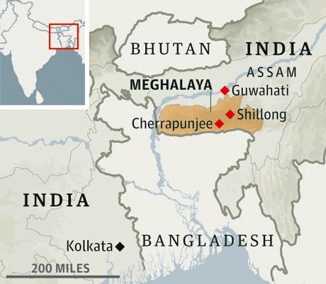
Mawsynram is a town in the East Khasi Hills district of Meghalaya state in northeastern India, 60.9 kilometres from Shillong.
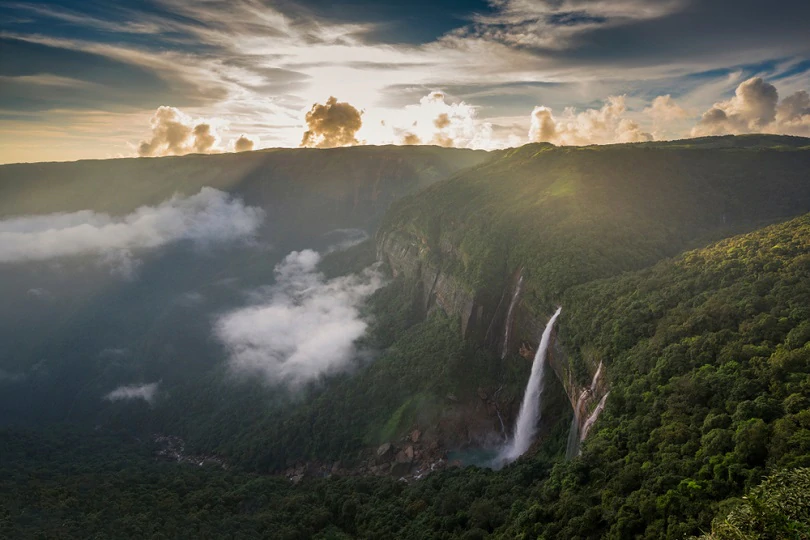
Mawsynram receives the highest rainfall in India.
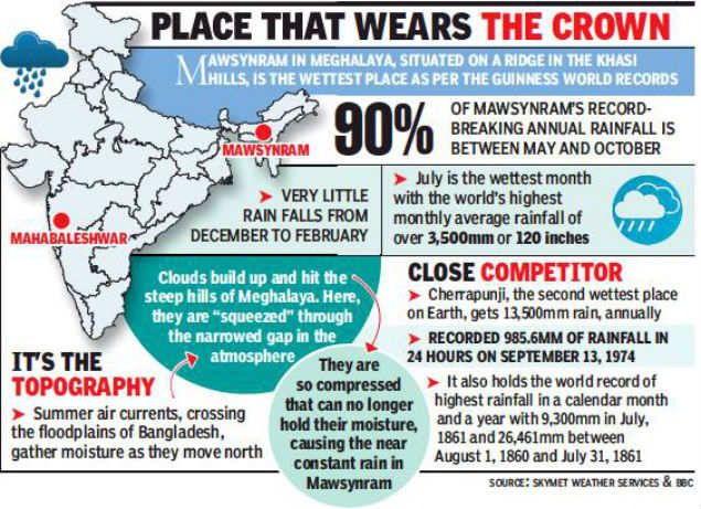
It is reportedly the wettest place on Earth, with an average annual rainfall of 11,872mm but that claim is disputed.
According to the Guinness Book of World Records, Mawsynram received 26,000 millimetres (1,000 in) of rainfall in 1985.
Why it rain highest in Mawsynram?
Because of the uneven relief of India due to the presence of a number of hill ranges, the monsoon is not able to shed its moisture evenly over India.
Windward sides receive more rainfall and leeward sides receive less rainfall.
Mawsynram lies in the funnel-shaped depression caused by the Khasi range in Meghalaya.
The Bay of Bengal branch of monsoons is trapped in it and causes heavy rainfall.
The research analysed daily rain gauge measurements during 1901–2019 and noted that the changes in the Indian Ocean temperature have a huge effect on the rainfall in the region.
There was a reduction in the vegetation area in northeast India in the past two decades, implying that human influence also plays an important role in the changing rainfall patterns.
The traditional way of cultivation known as Jhum cultivation or shifting cultivation is now decreased and being replaced by other methods.
Also, previous studies have noted there is sizable deforestation in the region.
Decreasing rainfall trends
Reasons:
Rising Temperature:
The changes in the Indian Ocean temperature have a huge effect on the rainfall in the region.
Increasing sea surface temperatures in the tropical Indian Ocean region was pointed out by the first climate change assessment report published by the Union Ministry of Earth Sciences in June 2020.Increased Human Activities:
The satellite data showed that there was a reduction in the vegetation area in northeast India in the past two decades, implying that human influence also plays an important role in the changing rainfall patterns.
The traditional way of cultivation known as Jhum cultivation or shifting cultivation is now decreased and being replaced by other methods.
There is sizable deforestation in the region. The study saw the decrease in vegetation cover and increase in the areas of cropland mainly from the year 2006 onwards.
The analysis showed reductions in vegetation with 104.5 sqkm lost per year.
On the other hand, there were significant increases in cropland (182.1 sqkm per year) and urban and built-up lands (0.3 sqkm per year) during the period 2001–2018.
Significance of Studying the North-East Region:
Since north-east India is mostly hilly and is an extension of the Indo-Gangetic Plains, the region is highly sensitive to changes in regional and global climate.
It has to be noted that the first signs of the effect of climate change will be evident for the extreme cases such as the rainfall at Cherrapunji.
North-east India has the highest vegetation cover in India and includes 18 biodiversity hotspots of the world, indicating the importance of the region in terms of its greenery and climate-change sensitivity.
 LIVE Online Class