The Indian Regional Navigation Satellite System (IRNSS) has been accepted as a component of the World Wide Radio Navigation System (WWRNS) for operation in the Indian Ocean Region by the International Maritime Organization (IMO).
What is IRNSS?
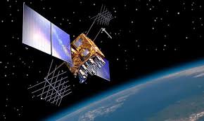
The IRNSS, with an operational name of NavIC (acronym for Navigation with Indian Constellation) is an Indian regional satellite navigation system that provides accurate real-time positioning and timing services.
It covers India and a region extending 1,500 km around it, with plans for further extension.
The system currently consists of a constellation of seven satellites, with two additional satellites on ground as stand-by.
The constellation is in orbit as of 2018, and the system was expected to be operational from early 2018 after a system check.
It will provide two levels of service, the “standard positioning service”, which will be open for civilian use, and a “restricted service” (an encrypted one) for authorised users (including the military).
Benefits of the move
This move will enable merchant vessels to use IRNSS for obtaining position information similar to GPS and GLONASS.
This will assist in the navigation of ships in Indian ocean waters within the area covered by 50°N latitude, 55°E longitude, 5°S latitude and 110°E longitude (approximately up to 1500 km from Indian boundary).
Services provided:
IRNSS would provide two types of services, namely Standard Positioning Services available to all users and Restricted Services provided to authorised users.
Its applications include:
Terrestrial, Aerial and Marine Navigation.
Disaster Management.
Vehicle tracking and fleet management.
Integration with mobile phones.
Precise Timing.
Mapping and Geodetic data capture.
Terrestrial navigation aid for hikers and travellers.
Visual and voice navigation for drivers.
International Maritime Organisation (IMO)
IMO is the UN specialized agency with responsibility for the safety and security of shipping and the prevention of marine pollution by ships.
Its primary purpose is to develop and maintain a comprehensive regulatory framework for shipping and its remit today includes safety, environmental concerns, legal matters, technical co-operation, maritime security and the efficiency of shipping.
IMO is governed by an assembly of members and is financially administered by a council of members elected from the assembly.
Utilities of this project
The navigation system has two categories of services provided. One is the Standard Positioning System (SPS) available to all the users based in India and the other will be Restricted Services, which are encrypted service available exclusively for the authorised users.
Science & Technology plays decisive role in building military strength of a country. In terms of Military Application, the project will be a force multiplier for the Indian Defence Unit. The wide spectrum of utility it serves from target fixing, missile and weapon delivery, avoiding civilian causalities, unit location and direction, vision clarity in bad weather etc. will enhance the capacity of defence both war and peace time.
As provided by ISRO few of the stated purposes include Terrestrial, Aerial and Marine Navigation, Disaster Management, Vehicle tracking and fleet management, Integration with mobile phones, Precise Timing, Mapping and Geodetic data capture, Terrestrial navigation aid for hikers and travellers and Visual and voice navigation for drivers. Government has recently marked 170 areas where the services of the system can be deployed.
Further with an extensive coverage, one of the stated future use of the project includes sharing of the project with the SAARC nations. This will help in integrating the regional navigation system further and a diplomatic goodwill gesture from India towards countries of the region
 LIVE Online Class